Esri Will Make ArcGIS Available on Kubernetes
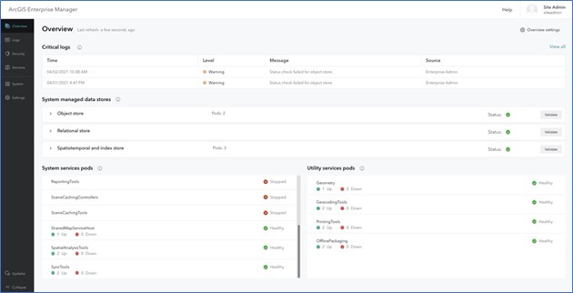
Esri announced today that in the second quarter of this year it will make available an instance of its geospatial information system (GIS) that can be deployed on Kubernetes clusters.
Philip Heede, a product manager for Esri, says that as Kubernetes becomes more widely deployed in the enterprise, the number of organizations looking to deploy Esri’s ArcGIS as a set of microservices running alongside other applications in a Kubernetes environment is steadily increasing. Over time, that architecture will make it easier for Esri to slipstream additional innovations into the platform as they are developed.
At the same time, developers are looking to embed location-based services within an application by calling an external application programming interface (API) that accesses ArcGIS. Alternatively, those developers would have to embed and maintain a geospatial database within their own application to provide location-based services.
As part of an effort to make it simpler to achieve that goal, Esri is making available a JavaScript API and Design System to access 2D and 3D data alongside support for the other programming tools and frameworks it already supports. That capability makes it easier for developers to leverage the power of client devices to process 2D and 3D data locally to improve the overall application experience.
Data visualization capabilities are now increasingly expected to be included in almost every application. The debate now is over how best to go about providing those capabilities, and at what cost.
In the meantime, Kubernetes is gaining traction within IT environments, because it enables IT teams to dynamically scale compute resources up and down as required.
That’s an especially critical requirement when running compute-intensive GIS applications. In addition, as edge computing platforms running Kubernetes become more widely available, there is also a need to scale out applications to enable data to be processed and analyzed at the point where it is being created and consumed.
Collectively, those capabilities will soon lead to a much larger number of independent software vendors (ISVs) deciding to enable their packaged applications to run natively on Kubernetes clusters.
It’s not clear to what degree the ability to deploy a GIS on Kubernetes might lead to increased usage of data visualization. At the very least, the number of options for deploying a GIS environment will increase. IT organizations that make use of Kubernetes enjoy the option to deploy any application almost anywhere they see fit.
Regardless of how GIS environments are employed, the one thing that is certain is that geospatial platforms have a significant role to play within the context of digital business transformation initiatives. Location plays a critical role in enabling organizations to know, for example, how to optimize a supply chain. In fact, the days when GIS platform were relied on by only a narrow set of users typically involved in an engineering project are long over. The challenge, now, is how best to go about making GIS available to any user, on-demand.


